One week after Hurricane Katrina moved through Alabama, Mississippi and Louisiana, Boston Chemical Data and the Mobile Register collected environmental samples along the Alabama and Mississippi coastlines. Extended Total Petroleum Hydrocarbons testing was performed by Alpha-Woods Hole Laboratories of Massachusetts. During our survey significant amounts of petroleum and fuels had been visibly released into waterways and surrounding wetlands. Boston Chemical Data also performed and managed sampling, monitoring well installation, and surveys related to the Murphy Oil Co. crude oil release in St. Bernard Parish, LA from October 2005 to September 2006. Photographs Below - Mobile, AL 9/08/05 BCD Photo. - Petroleum spill line well above mean high tide line, possibly due to release during Katrina Storm surge - Mobile River East Bank South of Cochran Bridge. (See test results at bottom of page)
Below - Gulf Shores, AL BCD 9/09/05 Photo. - Car carrier and shrimp boat grounded during Katrina Storm Surge at Bayou Batre. Bayou waters and wetlands showed moderate light hydrocarbon residues.
Below - Gulf Shores, AL BCD 9/09/05 Photo. - Boat ramp on Bayou Batre, home for the Gulf Shores Shrimping Fleet.
Below - Mobile, AL BCD 9/08/05 Photo. - Grounded barges on dry land beside the Mobile River. Note excavations made to reach the barges and rearward barge grounded on the wrong side of the tracks.
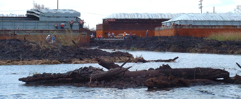
Below - Mobile, AL BCD 9/08/05 Photo. - Damaged terminal company on the Lower Mobile River. This location is upstream of the petroleum stained area pictured in the top photograph.
Below - Mobile, AL BCD 9/08/05 Photo. - Another angle of the same damaged terminal company on the Lower Mobile River.
Below - Mobile, AL BCD 9/08/05 Photo. - Saw grass with petroleum staining near waterline. This area is well upstream of the site pictured in the top photo and it experienced a much lower storm surge. This site is adjacent to an asphalt plant. (See test result 2 at bottom of page)
Below - Mobile, AL BCD 9/08/05 Photo. - This typical bayou camp house survives on the north side of a Mobile Delta island where south-facing homes were completely obliterated.
Below - Mobile, AL BCD 9/08/05 Photo. - This rig broke loose and was photographed underneath the Cochran Bridge in Mobile. By Sept. 8, 2005 it was already back in place but damaged.
Below - Pascagoula, Miss. BCD 9/09/05 Photo. - Chevron's Pascagoula, Miss., refinery handles 325,000 barrels of crude oil a day. It was the largest refinery knocked-out by Hurricane Katrina.
Below - Pascagoula, Miss. BCD 9/09/05 Photo. - Chevron facility
Below - Pascagoula, Miss. BCD 9/09/05 Photo. - Phosphate Plant on Bayou Canotte
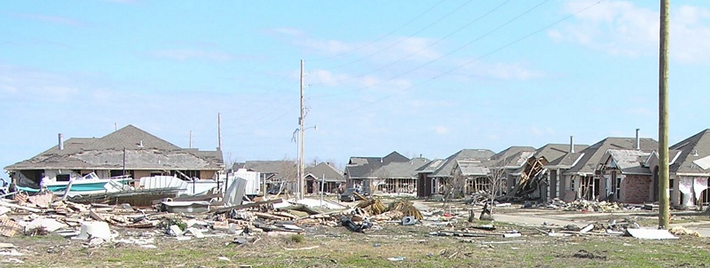
Below - Chalmette, LA. BCD 02/15/06 Photo. - Northward-facing leveefront home, 40 Arpent canal
|